Banggai Regency
Banggai Regency Kabupaten Banggai | |
|---|---|
Regency | |
 Seal | |
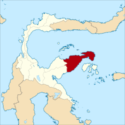 Location within Central Sulawesi | |
 Banggai Regency Location in Sulawesi and Indonesia Show map of Sulawesi  Banggai Regency Banggai Regency (Indonesia) Show map of Indonesia | |
| Coordinates: 0°57′26″S 122°33′31″E / 0.957091°S 122.558593°E / -0.957091; 122.558593Coordinates: 0°57′26″S 122°33′31″E / 0.957091°S 122.558593°E / -0.957091; 122.558593 | |
| Country | Indonesia |
| Region | Sulawesi |
| Province | Central Sulawesi |
| Capital | Luwuk |
| Government | |
| • Regent | Herwin Yatim |
| • Vice Regent | Mustar Labolo |
| Area | |
| • Total | 9,672 km2 (3,734 sq mi) |
| Population (2010) | |
| • Total | 323,626 |
| • Density | 33/km2 (87/sq mi) |
| Time zone | UTC+8 (ICST) |
| Area code | (+62) 461 |
| Website | banggaikab.go.id |
The Banggai Regency (Indonesian: Kabupaten Banggai) is a regency located at the eastern end of Central Sulawesi Province of Indonesia. It makes up a re-established regency (kabupaten), created by splitting the existing Banggai Regency into this smaller Banggai Regency situated on the mainland of Sulawesi (capital, Luwuk) and a new Banggai Islands Regency comprising the offshore islands (capital, Banggai town); the archipelago is separated from mainland Sulawesi by the Peleng Straits (Selat Peleng).
Administration
The Banggai regency was divided at 2010 into eighteen districts (kecamatan), tabulated below with their areas and their 2010 Census populations.[1]
| Name | Area in sq.km | Population Census 2010 |
|---|---|---|
| Nuhon | 791.07 | 17,886 |
| Simpang Raya | 253.01 | 13,589 |
| Bunta | 576.38 | 18,277 |
| Lobu | 58.07 | 3,323 |
| Pagimana | 958.71 | 22,223 |
| Bualemo | 872.84 | 16,968 |
| Balantak | 277.03 | 9,300 |
Balantak Selatan (South Balantak) | 91.61 | 4,455 |
| Lamala | 321.68 | 12,510 |
| Masama | 263.32 | 10,517 |
Luwuk Timur (East Luwuk) | 243.14 | 10,557 |
| Luwuk | 411.50 | 73,905 |
| Kintom | 492.18 | 13,023 |
| Batui | 515.40 | 14,725 |
Batui Selatan (South Batui) | 639.15 | 12,847 |
| Moilong | 120.89 | 18,097 |
| Toili | 734.13 | 30,716 |
Toili Barat (West Toili) | 504.21 | 20,708 |
References
^ Biro Pusat Statistik, Jakarta, 2011.
External links
- Official website
Regencies and cities of Central Sulawesi | ||
|---|---|---|
Capital: Palu | ||
| Regencies |
| |
| City |
| |
This Central Sulawesi location article is a stub. You can help Wikipedia by expanding it. |